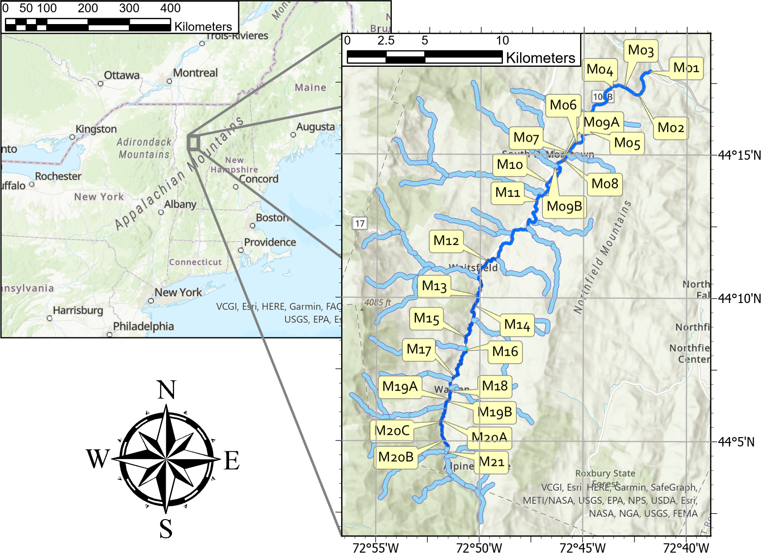
Centuries of human development have altered the connectivity of rivers, adversely impacting ecosystems and the services provided. Significant investments in natural resource projects are made annually with the goal to restore function to degraded rivers and floodplains and protect freshwater resources. Yet restoration projects often fall short of their objectives, in part, due to the lack of systems-based, strategic planning. To evaluate channel-floodplain (dis)connectivity and erosion/incision hazard at the regional scale, we calculate Specific Stream Power (SSP), an estimate of the energy of a river, using a topographically-based, low-complexity hydraulic model. Other basin-wide SSP modeling approaches neglect reach-specific geometric information embedded in Digital Elevation Models. Our approach leverages this information to generate reach-specific SSP-flow curves. We extract measures from these curves that describe (dis)connected floodwater storage capacity and erosion hazard at individual design storm flood stages and demonstrate how these measures may be used to identify watershed-scale patterns in connectivity. We show proof-of-concept using 25 reaches in the Mad River watershed in central Vermont and demonstrate that the SSP results have acceptable agreement with a well-calibrated process-based model (2D Hydraulic Engineering Center’s River Analysis System) across a broad range of design events. While systems-based planning of regional restoration and conservation activities has been limited largely due to computational and human resource requirements, measures derived from low complexity models can provide an overview of reach-scale conditions at the regional level and aid planners in identifying areas for further restoration and/or conservation assessments.