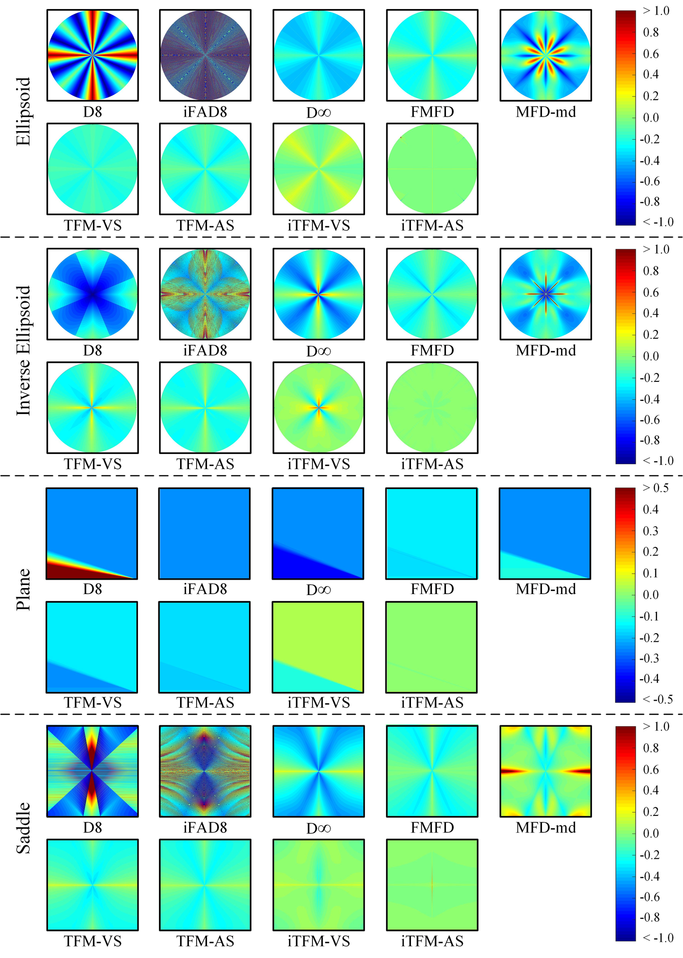
The naturally-existing diffusive flow makes the multiple flow direction (MFD) algorithm for digital elevation models with revisited values. However, owing to a generally accepted hypothesis, i.e., flow over a grid cell is uniformly distributed ignoring the micro-topography and the inflow direction/position, nearly no existing MFD algorithms can simultaneously force the flow along the exact dispersive path, and provide highly accurate hydrological/geomorphological parameters. In this study, an improvement Triangular Form-based Multiple Flow Algorithm called iTFM is proposed to limit the arbitrary dispersion caused by the conventional hypothesis through considering the nonuniform flow domain within a cell. In the new algorithm, each facet flow and its inflow direction/position are considered to route the flow along the local aspect over partial areas to downstream facets or cells. Facets with or without inflow can behave quite nonuniformly in contributing areas, namely flow domains. This procedure is adopted to generalize the nonuniformity and route the flow to the exact downstream facets. Quantitative assessments using artificial terrains show that iTFM suppresses the artificial dispersion effectively and extracts the flow paths highly consistent with the exact ones. Compared with previous algorithms, iTFM provides the most accurate total contributing areas. In addition, vector split and area split strategies are compared for flow split within a facet which is a necessary step in both TFM and iTFM, and the results prove that area split is more efficient. Hence, it can be concluded that the iTFM algorithm combined with the area split strategy can better define the dispersion flow path.