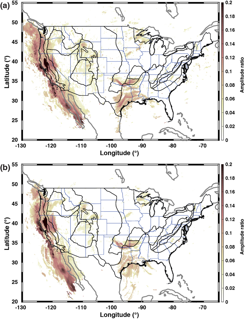
Body-to-surface wave scattering, originated from strong lateral heterogeneity, has been observed and modeled for decades. Compared to body waves, scattered surface waves propagate along the Earth’s surface with less energy loss and, thus, can be observed over a wider distance range. In this study, we utilize surface waves converted from teleseismic SH or Sdiff wave incidence to map strong lateral heterogeneities across the entire contiguous US. We apply array-based phase coherence analysis to broadband waveforms recorded by the USArray Transportable Array and other permanent/temporary networks to detect coherent signals that are associated with body-to-surface wave scattering. We then locate the source of the scattering by back-propagating the beamformed energy using both straight-ray and curved-ray approximations. Our results show that the distribution of scatterers correlates well with known geological features across the contiguous US. Topographic/bathymetric relief along the continental slope off the Pacific Border is the major source of scattering in the western US. On the other hand, sedimentary basins, especially their margins, are the dominant scatterers in the central US. Moho offsets, such as the one around the periphery of the Colorado Plateau, are also a strong contributor to scattering, but isolating their effect from that of other near-surface structures without any additional constraints can be complicated. Finally, we demonstrate the possibility of using scattered surface waves to constrain subsurface velocity structures, as complementary to conventional earthquake- or ambient-noise-based surface wave tomography.