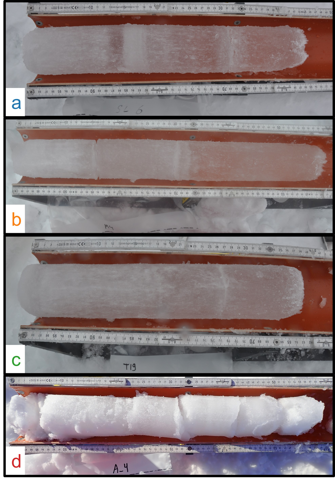
An improved understanding of the seasonality of the Arctic snowpack properties related to the timing and intensity of snowmelt processes is the key driver to better quantify atmosphere-ice-ocean interactions, and in particular the seasonal energy and mass budgets of the ice-covered polar oceans. Various satellite data products over the last decades have shown a trend towards an earlier snowmelt onset in the Arctic, thus contributing to Arctic amplification and sea-ice decline, underlining the need to better understand these processes. We present here the physical snow properties from spring 2020 examined during the “Multidisciplinary drifting Observatory for the Study of Arctic Climate” (MOSAiC). We focus on southerly air mass advection events in mid-April that were associated with near-surface air temperatures near freezing at the MOSAiC floe. In doing so, we emphasize a single sampling site that was revisited daily-to-weekly throughout the spring. At the sampling site, snow depth ranged from 10 to 14 cm with the bulk density varying between 200 to 350 kg m-3, mainly driven by freshly fallen snow. The vertical snow structure prior to the warm event was characterized by large pores with distinct snow crystal structures and widespread depth hoar crystals, both related to the strong temperature gradient in the snowpack. During the warm air intrusion, increasing temperatures temporarily reversed the thermal gradient in the snow. The warm snow surface, now above a relatively cold snow/ice interface, resulted temporary negative vertical heat flux values observed to be up to -12 Wm-2. Because the snow/ice interface is close to freezing, the negative flux is an indicator that melt may have occurred. Once temperatures dropped again, the vertical temperature and heat flux gradients returned back to the previous patterns. However, the decreased snow grain sizes throughout the snowpack due to the warming and the associated compacted lower layers now dominated the snowpack. Such a temporary warm spell event has decisive impacts on the sea-ice energy and mass budget of the MOSAiC floe. Understanding this effect on a local scale will help to transfer that knowledge to larger spatial scales, and thus to quantify the influence of warm air intrusions during winter and/or spring in the ice-covered Arctic basin.