Augusto Getirana

and 3 more

It is known that representing wetland dynamics in land surface modeling improves models’ capacity to reproduce fluxes and land surface boundary conditions for atmospheric modeling in general circulation models. This study presents the development of the full coupling between the Noah-MP land surface model (LSM) and the HyMAP flood model in the NASA Land Information System and its application over the Inner Niger Delta (IND), a well-known hot-spot of strong land surface-atmosphere interactions in West Africa. Here, we define two experiments at 0.02º spatial resolution over the 2002-2018 period to quantify the impacts of the proposed developments on IND dynamics. One represents the one-way approach for simulating land surface and flooding processes (1-WAY), i.e., Noah-MP neglects surface water availability, and the proposed two-way coupling (2-WAY), where Noah-MP takes surface water availability into account in the vertical water and energy balance. Results show that accounting for two-way interactions between Noah-MP and HyMAP over IND improves all selected hydrological variables. Compared to 1-WAY, evapotranspiration derived from 2-WAY over flooding zones doubles, increased by 0.8mm/day, resulting in an additional water loss rate of ~18,900km3/year, ~40% drop of wetland extent during wet seasons and major improvement in water level variability at multiple locations. Significant soil moisture increase and surface temperature drop were also observed. Wetland outflows decreased by 35%, resulting in a substantial a Nash-Sutcliffe coefficient improvement, from -0.73 to 0.79. It is anticipated that future developments in global water monitoring and water‐related disaster warning systems will considerably benefit from these findings.
The Congo basin is one of the most hydrologically active and pristine locations with limited understanding of how precipitation changes impacts on stream flow dynamics and variations in catchment stores. Given that the basin is among the three prominent convective regions that dominates global rainfall climatology during transition seasons, historical space-time variability of rainfall (1901-2014) over the basin in relation to river discharge is analyzed in order to understand significant hydro-climatic shift. Based on advance multivariate analyses, the total variability of the leading modes (annual variations) of rainfall increased during the 1931-1960 (56.3%) and 1961-1990 (57.3%) periods compared to the 1901-1930 baseline period (51.3%). It varied less between 1991 and 2014 (55.4%) as opposed to the two climatological periods between 1931 and 1990. Furthermore, the total variability in the multi-annual rainfall signals declined from 16.5% at the start of the century (1901-1930) to 13.6% in the 1991-2014 period while the total variability accounted for by other short-term meteorological signals oscillated between 4.0% and 2.7% during the entire period. Between 1995 and 2010 there seems to be a change in the hydrological regimes of the Congo river as the cumulative departures of rainfall and discharge were in opposite directions. The considerable association of discharge with rainfall in catchments characterized by strong annual and seasonal amplitudes in rainfall implies that the wetland hydrology of the basin is largely nourished by rainfall, in addition to possible exchange of fluxes within the Congo floodplain wetlands. Notably, a significant proportion of changes in the dominant rainfall patterns is still not explained by those of river discharge. This information signals the threshold of complex hydrological processes in the region, and perhaps suggest the influence of anthropogenic contributions (e.g., deforestation) and strong multi-scale ocean-atmosphere phenomena as key secondary drivers of hydrologic variability.
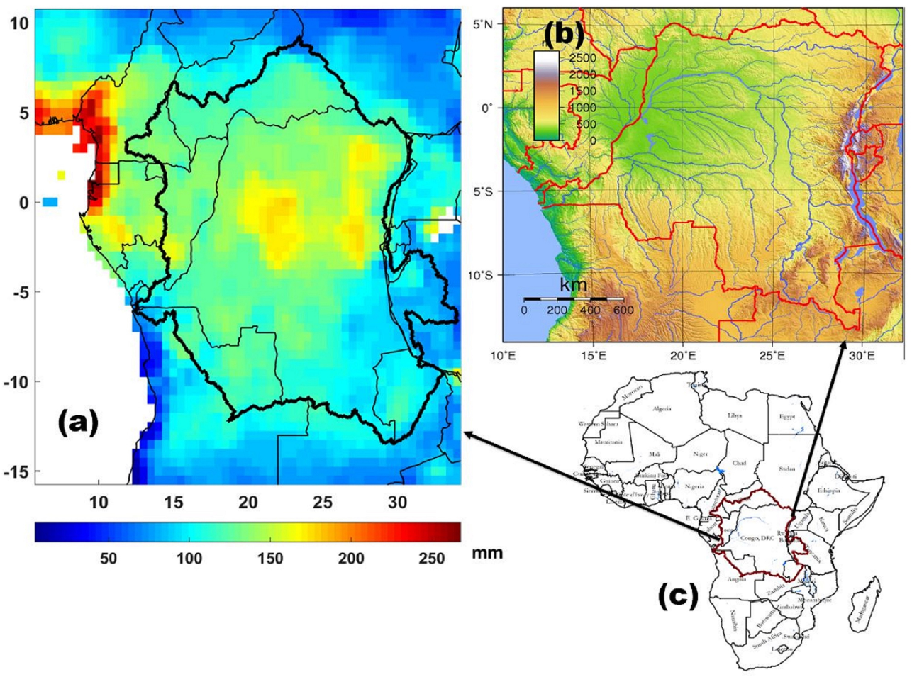
Understanding the impacts of climate on surface water hydrology is required to predict consequences and implications on freshwater habitats, ecological assets, and wetland functions. Although the Congo basin is considerably a freshwater-rich region, largely characterised by numerous water resources after the similitude of the Amazon basin, recent accounts of droughts in the basin are indications that even the most humid regions of the world can be affected by droughts and its impacts. Given the scarcity and limited availability of hydrological data in the region, GRACE (Gravity Recovery and Climate Experiment) observations are combined with model and SPEI (standardized precipitation evapotranspiration index) data to investigate the likelihood of such impacts on the Congo basin’s surface water hydrology. By integrating multivariate analysis with support vector machine regression (SVMR), this study provides some highlights on the characteristics (intensity and variability) of drought events and GRACE-derived terrestrial water storage (TWS) and the influence of global climate on the Congo river discharge. The southern section of the basin shows considerable variability in the spatial and temporal patterns of SPEI and extreme droughts over the Congo basin appear to have persisted with more than 40% coverage in 1994. However, there has been a considerable fall in drought intensities since 2007 and coincides with periods of strong positive anomalies in discharge (i.e., 2007-010). GRACE-derived TWS over the Congo basin is driven by annual fluctuations in rainfall (r = 0.81 at three months phase lag) and strong inter-annual variations of river discharge (r = 0.88, α= 0.05). Generally, results show that changes in the surface water variations (from gauge and model output) of the Congo basin is a key component of the GRACE water column. The outputs of the SVMR scheme indicate that global climate through sea surface temperature anomalies of the Atlantic (r = 0.79, α= 0.05), Pacific (r = 0.79, α= 0.05), and Indian (r = 0.74, α= 0.05) oceans are associated with fluctuations in the Congo river discharge, and confirm the importance of climatic influence on surface water hydrology in the Congo basin.