Jonathan Sanderman

and 5 more

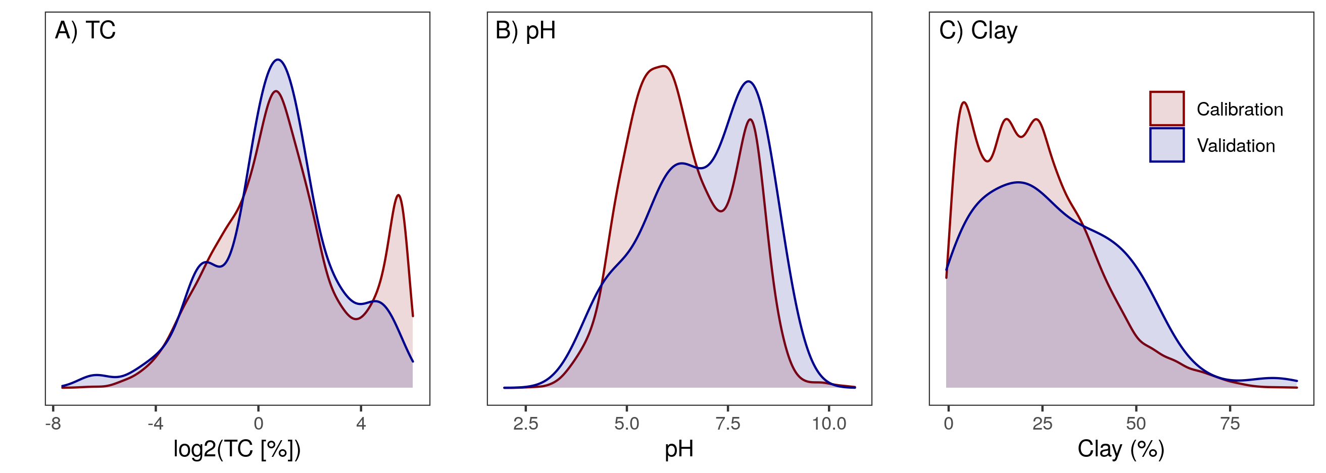
Large and publicly available soil spectral libraries, such as the USDA National Soil Survey Center – Kellogg Soil Survey Laboratory (NSSC-KSSL) mid infrared (MIR) spectral library, are enormously valuable resources enabling laboratories around the world to make rapid estimates of a number of soil properties. A limitation to widespread sharing of soil spectral data is the need to ensure that spectra collected on a local spectrometer are compatible with the spectra in the primary or reference library. Various spectral preprocessing and calibration transfer techniques have been proposed to overcome this limitation. We tested the transferability of models developed using the USDA NSSC-KSSL MIR library to a secondary instrument. For the soil properties, total C (TC), pH and clay content, we found that good performance (RPD = 4.9, 2.0 and 3.6, respectively) could be achieved on an independent test set with Savitzky-Golay (SG) smoothing and first derivative preprocessing of the secondary spectra using a memory-based learning chemometric approach. We tested three calibration transfer techniques (direct standardization (DS), piecewise direct standardization (PDS), and spectral space transformation (SST)) using different size transfer sets selected to be representative of the entire NSSC-KSSL library. Of the transfer methods, SST consistently outperformed DS and PDS with 50 transfer samples being an optimal number for transfer model development. For TC and pH, performance was improved using the SST transfer (RPD = 7.7 and 2.2, respectively) primarily through the elimination of bias. Calibration transfer could not improve predictions for clay. These findings suggest calibration transfer may not always be necessary but users should test to confirm this assumption using a small set of representative samples scanned at both laboratories.

Sumanta Chatterjee

and 4 more

Drought is a recurring and extreme hydroclimatic hazard with serious impacts on agriculture and overall society. Delineation and forecasting of agricultural and meteorological drought are essential for water resource management and sustainable crop production. Agricultural drought assessment is defined as the deficit of root-zone soil moisture (RZSM) during active crop growing season, whereas meteorological drought is defined as subnormal precipitation over months to years. Several indices have been used to characterize droughts, however, there is a lack of study focusing on comprehensive comparison among different agricultural and meteorological drought indices for their ability to delineate and forecast drought across major climate regimes and land cover types. This study evaluates the role of RZSM from Soil Moisture Active Passive (SMAP) mission along with two other soil moisture (SM) based indices (e.g., Palmer Z and SWDI) for agricultural and meteorological drought monitoring in comparison with two popular meteorological drought indices (e.g., SPEI and SPI) and a hybrid (Comprehensive Drought Index, CDI) drought index. Results demonstrate that SM-based indices (e.g., Palmer Z, SMAP, SWDI) delineated agricultural drought events better than meteorological (e.g., SPI, SPEI) and hybrid (CDI) drought indices, whereas the latter three performed better in delineating meteorological drought across the contiguous USA during 2015–2019. SM-based indices showed skills for forecasting agricultural drought (represented by end-of-growing season gross primary productivity) in the early growing seasons. The results further confirm the key role of SM on ecosystem dryness and corroborate the SM-memory in land-atmosphere coupling.

Jingyi Huang

and 8 more

Soil water is essential for maintaining global food security and for understanding hydrological, meteorological, and ecosystem processes under climate change. Successful monitoring and forecasting of soil water dynamics at high spatio-temporal resolutions globally are hampered by the heterogeneity of soil hydraulic properties in space and complex interactions between water and the environmental variables that control it. Current soil water monitoring schemes via station networks are sparsely distributed while remote sensing satellite soil moisture maps have a very coarse spatial resolution. In this study, an empirical surface soil moisture (SSM) model was established via data fusion of remote sensing (Sentinel-1 and Soil Moisture Active and Passive Mission - SMAP) and land surface parameters (e.g. soil texture, terrain) using a quantile random forest (QRF) algorithm. The model had a spatial resolution of 100 m and performed moderately well across the globe under cropland, grassland, savanna, barren, and forest soils (R = 0.53, RMSE = 0.08 m m). SSM was retrieved and mapped at 100 m every 6-12 days in selected irrigated cropland and rainfed grassland in the OZNET network, Australia. It was concluded that the high-resolution SSM maps can be used to monitor soil water content at the field scale for irrigation management. The SSM model is an additive and adaptable model, which can be further improved by including soil moisture network measurements at the field scale. Further research is required to improve the temporal resolution of the model and map soil water content within the root zone.