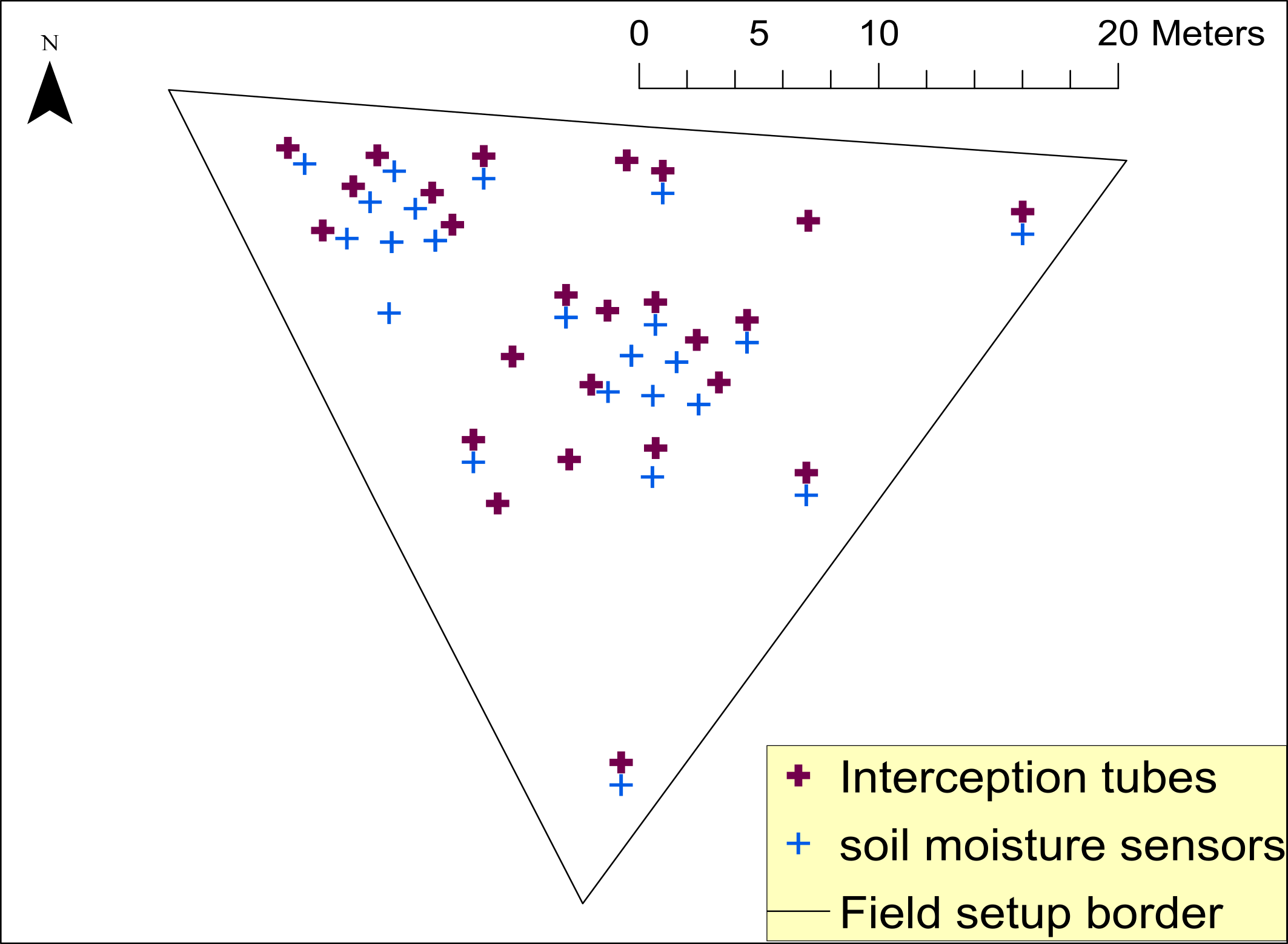
Canopies shape net precipitation patterns, which are spatially heterogeneous and control soil moisture response to rainfall. The vast majority of studies on canopy water fluxes were conducted in forests, whereas grassland canopies are often assumed to be spatially homogeneous, therefore likely not inducing patches of heterogeneity at and below the soil surface. Yet, some studies on short-structured vegetation, such as grasslands, proposed the importance of canopy-induced heterogeneity for net precipitation, but systematic investigations on the effects on soil wetting patterns are missing. Therefore, in this study, we investigated soil moisture response to rainfall in a managed temperate grassland by exploring the individual impacts of spatially varying throughfall, vegetation height and antecedent soil moisture status on the soil wetting patterns. We applied linear mixed effects models to disentangle the role of grassland canopy versus abiotic drivers. The spatial average soil water response showed that less and less water was stored in the upper parts of the soil as the growing season progressed and the soils dried, indicating bypass flow. Spatial variation of grass height was a significant driver of soil wetting patterns along with precipitation and antecedent soil moisture status. Soil wetting was suppressed in locations with tall canopy, although surprisingly this was not directly related to throughfall patterns. Instead, our results suggest that seasonally drier conditions and grassland stemflow kick off preferential flow. Ultimately, our results confirm that spatial variation of the canopy affects soil moisture wetting patterns not only in forests and indicate a strong influence of preferential flow on soil water patterns.