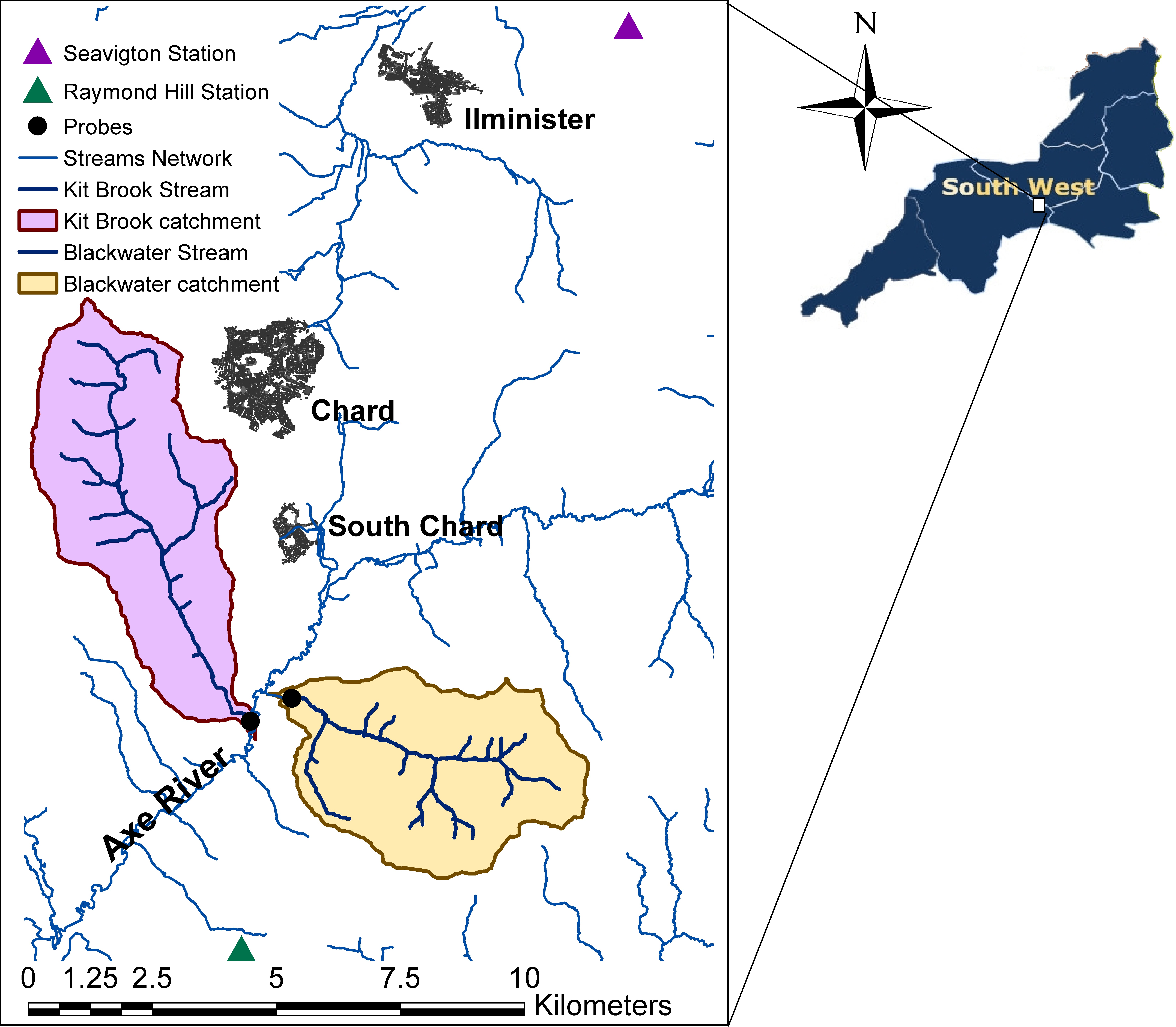
Agricultural land use can increase runoff and erosion leading to detrimental downstream impacts. This paper examines the impact of agricultural land cover change on runoff and sediment generation at event scales using a model-based approach. SHETRAN, a physically based, spatially distributed model, was applied in two southwest England catchments to represent: (a) changes in the land cover (cropland extent and spatial arrangement), (b) changes in crop type, and (c) use of riparian buffer strips. A total of 84 simulated events within a 4-year period were used to quantify flow and sediment generation impacts. We found past changes in land cover resulted in significant differences in sediment yield (p < 0.05). Linear regression showed an increase in flow and sediment yield proportional to increases in arable crop area (p < 0.001). The spatial arrangement of cropped fields and riparian buffer strips produced no significant differences in event flow or sediment yield (p > 0.05). However, buffer strip scenarios compared with the base run showed sediment load reductions in specific events, up to 20% and 15% for woodland and grass riparian buffers, respectively. When comparing crop types with and without the use of post-harvest cover crops, we observed non-significant differences (both Qv and Sy). However, large reductions in modelled sediment yields occurred for some events (e.g., up to 60% for winter cereals, 50% for maize and 74% for spring cereals). For these scenarios, examination of rainfall event magnitude emphasized the importance of ground cover in mitigating soil erosion for maize and spring cereals, but not for winter cereals. Our findings indicate that significant changes in sediment delivery at the event scale are associated with cropland extent and crop types, depending on rainfall magnitude, but not on the spatial arrangement of cropped fields or the use of riparian buffer strips.